Colorado wildfires consume 200 square miles as crews brace for extreme weather
Published in News & Features
Hundreds of firefighters battling five wildfires across Colorado may see extreme fire behavior in the coming days, with state leaders bracing for a weather forecast of near-zero humidity, triple digit temperatures and strong winds.
“If you care about our state, if you care about our firefighters, do not use fireworks or other types of flames this Fourth of July weekend,” Gov. Jared Polis said at a news conference in Pueblo County on Thursday afternoon, where the Aspen Acres fire has burned more than 50,000 acres and destroyed an estimated 200 buildings.
“We cannot handle another major incident in our state right now,” Polis continued.
Four of the five major wildfires in Colorado are burning with zero containment and threatening thousands of homes and buildings in Pueblo, Custer, Montezuma, Ouray and Lake counties.
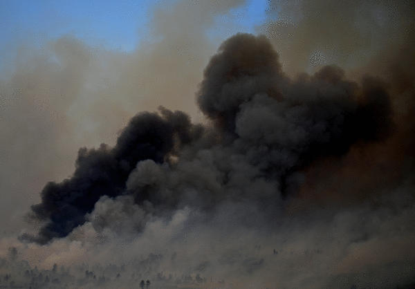
Together, the Aspen Acres, Gold Mountain, Snyder, Ferris and Willow fires have charred roughly 128,000 acres — 200 square miles — as of Thursday afternoon.
Colorado’s largest wildfire, the Aspen Acres fire, grew to 50,187 acres as of Thursday afternoon, up from 47,953 acres from Wednesday night. The burn area is roughly 78 square miles.
The Aspen Acres fire was declared the No. 1 priority in the nation on Wednesday, fire officials said.
A complex incident management team from Alaska took command of the fire at 6 a.m. Thursday and ordered 100 fire engines that are heading to Colorado from California, incident commander Jake Livingston said.
The team also ordered 17 hand crews, six dozers and 15 water tenders to respond to the fire.
Aspen Acres fire in Custer and Pueblo counties
The Aspen Acres fire sparked Monday morning in southern Colorado and grew rapidly. It nearly doubled in size on Wednesday alone, prompting a wave of new evacuations as it jumped from an estimated 28,363 acres to 47,953 acres with no containment.
The fire is burning on 50,187 acres as of Thursday afternoon, fire officials said.
As of Thursday afternoon, the Aspen Acres fire had destroyed more than 180 structures and injured a firefighter, according to the Pueblo County Sheriff’s Office. At least 125 structures have been destroyed in Pueblo County, and another 55 — primarily homes — were lost in Custer County.
Pueblo County Sheriff David Lucero said the number of burned buildings was likely higher, but the fire has blocked first responders from accessing the area for a more accurate count.
Authorities said the following areas are under mandatory evacuation orders:
Town of Wetmore: North of Wetmore to Fremont County and Pueblo, closing Colorado 96
Colorado City: North of Highway 165, east of Table Mountain Church, and west of Crow Cutoff
Red Creek Ranch: North of Colorado 78 and south of Colorado 96, west of Siloam Road and east to the Red Creek Springs area
The North Creek area from Central Road to the Custer County LineAspen Acres subdivision
Property on 12 Mile Road
South Pine Drive
Beulah
Rye
San Isabel Lake
Bishop Castle
Evacuated residents can seek shelter at the Pueblo County Recreation Center, 1650 Cooper Place; the Wetmore Community Center, 95 County Road 393; or at Pathfinder Park in Florence, 6655 Colorado 115.
As of Thursday morning, according to the Colorado Department of Transportation, the following road closures were in effect:
Colorado 96 in both directions between Butler Street in Silver Cliff and Siloam Road west of Pueblo
Southbound Colorado 67 between Cap Rock Road and Colorado 96 south of Florence
Colorado 165 in both directions between Colorado 96 and Colorado Boulevard in Colorado City
Colorado 78 in both directions between Colorado 165 and Rock Creek Road west of Pueblo
The wildfire was reported as a spot fire near the Aspen Acres campground shortly before 6 a.m. Monday. It grew to 362 acres by 10 a.m., reached 2,476 acres around noon and exploded in size to 22,827 acres Monday evening, according to fire officials.
The Federal Emergency Management Agency authorized the use of federal funds to help with the firefighting costs on Tuesday. FEMA officials said the Aspen Acres fire “threatened such destruction that it would constitute a major disaster.”
Federal funding will cover 75% of the state’s eligible firefighting costs, including for field camps; equipment use, repair and replacement; mobilization and demobilization activities; and tools, materials and supplies.
Officials with the U.S. Forest Service and the Colorado Department of Public Safety are investigating the cause of the fire, according to the Custer County Sheriff’s Office.
Gold Mountain fire near Ouray
The Gold Mountain fire had scorched 18,005 acres, or 28 square miles, with no containment as of Wednesday evening, according to Rocky Mountain Area Complex Incident Management Team 3, which is leading the fire response.
That’s up more than 3,000 acres from the 14,960-acre estimate reported Wednesday morning, and more than double the 8,277-acre burn area reported on Tuesday. As of Wednesday, the fire’s footprint was bigger than the city of Boulder.
The wildfire sparked Saturday north of Ouray, forcing evacuations. Colorado Gov. Jared Polis issued a disaster declaration for the Gold Mountain fire on Sunday.
As of Thursday morning, mandatory evacuation orders remained active west of the fire, according to Ouray County’s evacuation map.
The southern evacuation zone included Lake Lenore and was bordered to the west by U.S. 550, to the north by Cutler Creek, to the east by the wildfire burn area and to the south by Bridalveil Creek. The northern evacuation zone was bordered to the west by Ouray County Road 10, to the north by Cow and Deer creeks, to the east by Lou Creek Pass and to the south by Bald Peak and the wildfire.
Pre-evacuation orders were also issued for southwest Gunnison County, along Coal Creek and the Cimarron Ridge, according to the map.
An evacuation shelter was opened at the Ridgway Secondary School, 1200 Green St., according to county officials.
The Federal Emergency Management Agency has authorized the use of federal funds to help with the firefighting costs for the Gold Mountain fire, the Colorado governor’s office announced Wednesday. FEMA will cover 75% of the state’s eligible firefighting costs.
When Polis requested federal aid, the fire was threatening 266 homes and had forced more than 400 people to evacuate, according to the office.
Ferris fire in San Juan National Forest, near Dolores
The Ferris fire, which started Saturday as three separate fires north of Dolores in southwestern Colorado’s San Juan National Forest, has consumed more than 27,000 acres with no containment, according to federal officials.
As of Wednesday evening, the lightning-sparked wildfire was estimated to be burning on 27,382 acres, according to fire officials. That’s just over 42 square miles, larger than Grand Junction.
Mandatory evacuations were issued for residents east and west of the wildfires, according to the Dolores County Office of Emergency Management. The eastern evacuation area was bordered to the north by Disappointment Road, to the south by the Glade Ranch community, to the west by the fire and to the east by Lone Mesa, according to the office. The western zone was bordered to the north by County Road J, to the south by County Road S, to the west by Cahone and to the east by the Bradfield area.
The U.S. Forest Service also closed the Bradfield Bridge Campground, Forest Service Road 504 to the base of McPhee Dam, Forest Service Road 521 and Forest Service Road 504 “out of an abundance of caution,” federal officials said.
Colorado Parks and Wildlife on Tuesday cut off public access to the Lone Dome State Wildlife Area in Dolores and Montezuma counties, according to a news release from the agency. As fire conditions continue to change, further closures may be put into place for public safety and to support firefighting efforts, wildlife officials said.
Willow fire near Leadville
The Willow fire sparked Sunday evening near Leadville and quickly grew across more than 2,000 acres, prompting evacuations for residents west of town.
By Wednesday evening, the fire had spread to an estimated 2,207 acres with no containment in the San Isabel National Forest, according to Southwest Area Incident Management Team 4, which is leading the fire response. That’s roughly 3 square miles, or half the size of Breckenridge.
The wildfire was first reported at about 4:20 p.m. Sunday by the Lake County Office of Emergency Management. At that time, it was burning on a handful of U.S. Forest Service acres below Mount Massive, near Twin Mounds, county officials said.
Colorado Gov. Jared Polis issued a disaster declaration for the fire on Monday.
As of Thursday morning, the mandatory evacuation area included Turquoise Lake and was bordered to the south by Rock Creek, to the west by Hagerman Pass, to the north by Galena Mountain and to the east by Leadville, according to the Lake County evacuation map. The Leadville area and homes north of the fire along U.S. 24 were on pre-evacuation status at that time.
The cause of the fire remains under investigation.
Snyder fire in Mesa County and Utah
Activity on the Snyder fire dwindled on Wednesday as crews gained containment around the wildfire’s perimeter.
As of Wednesday evening, the Snyder fire had consumed 30,193 acres with 49% containment, according to the Rocky Mountain Complex Incident Management Team in charge. That’s roughly 47 square miles and nearly the size of Denver International Airport, which operates on 34,000 acres.
Containment doesn’t mean the fire is fully extinguished, but that crews have managed to secure a control line around a section of the fire’s perimeter. If firefighters construct a fire line around the fire’s entire perimeter, the blaze is considered 100% contained. Crews then remain in the area to extinguish hot spots and ensure the containment holds.
The Snyder fire is the result of Utah’s Snyder Mesa and Jones fires merging and moving into western Colorado, consuming the Western Slope’s Knowles and Gore fires. The flames overtook a group of firefighters responding to the Mesa County fires, killing three of them.
Colorado Gov. Jared Polis issued a disaster declaration for the fire on Saturday.
All evacuations and pre-evacuations were lifted at 7 p.m. Wednesday, according to the Mesa County Sheriff's Office.
Air quality alerts
As wildfires continue to burn across Colorado, state health officials have issued another air quality advisory for the western state.
The newest alert from the Colorado Department of Public Health and Environment will remain in effect until at least 9 a.m. Friday, according to the agency.
Smoke could create unhealthy conditions in Chaffee, Clear Creek, Custer, Delta, Dolores, Eagle, Elbert, El Paso, Fremont, Garfield, Gilpin, Grand, Gunnison, Jackson, Lake, Mesa, Moffat, Montezuma, Montrose, Ouray, Park, Pitkin, Pueblo, Rio Blanco, Routt, Saguache, San Miguel, Summit and Teller counties, according to state health officials.
If the smoke drops visibility to less than 5 miles in an area, it has reached unhealthy levels, according to the agency. Those with heart disease and respiratory illnesses, young children and older adults are more at risk.
©2026 MediaNews Group, Inc. Visit at denverpost.com. Distributed by Tribune Content Agency, LLC.


Comments